
OUR SERVICES
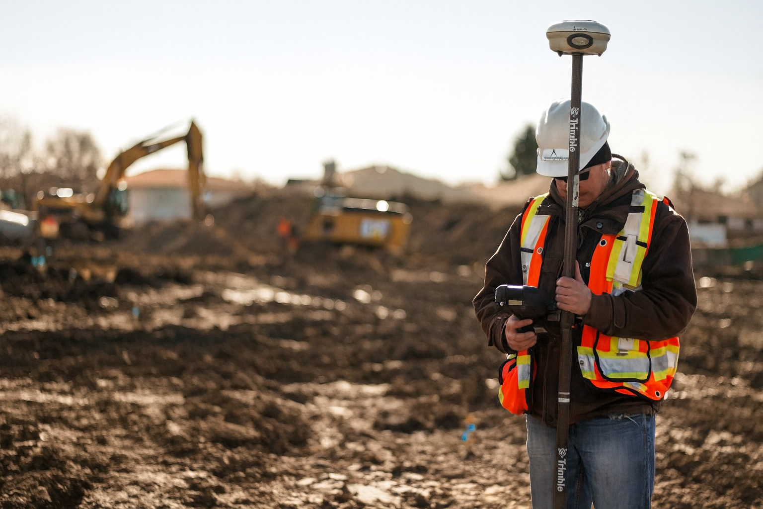
CONSTRUCTION SURVEY
Our Construction Survey services deliver precise, reliable layout and measurement support throughout every phase of your building project. From pre-construction control and site layout to ongoing verification and final as-built documentation, we provide the accurate field data required to ensure construction proceeds exactly as designed. Our surveys establish critical horizontal and vertical control, confirm elevations and alignments, and support structural, civil, and utility installation with confidence.
With more than 20 years of field and drafting experience, our team understands both the technical requirements and the practical realities of construction. We translate design drawings into accurate, buildable layout while identifying potential issues early to reduce delays, rework, and costly corrections. Our experience spans commercial, industrial, infrastructure, and utility projects, allowing us to adapt to complex site conditions and tight schedules.
We work closely with contractors, engineers, and project managers to deliver fast, dependable data that keeps projects moving and crews productive. Through clear communication, responsive service, and consistent accuracy, we support safe, efficient construction from initial layout through final verification—delivering results with Precision You Can BUILD ON.

BATHYMETRIC SURVEY
Our bathymetric survey services provide precise mapping and analysis of underwater terrain for lakes, rivers, creeks, and other water bodies. By accurately capturing subsurface conditions, these surveys deliver critical insight into depth variations, channel geometry, and bottom features that are not visible from the surface. This information is essential for understanding hydraulic behavior, sediment movement, and site constraints in aquatic environments.
Using advanced sonar systems integrated with high-precision GPS positioning, we measure water depths and collect dense datasets that are processed into detailed bathymetric surfaces, contours, and topographic maps of the seabed or riverbed. The resulting deliverables support a wide range of applications, including navigation assessments, dredging design and monitoring, environmental and habitat studies, hydraulic and flood modeling, and marine or waterfront construction projects.
With a focus on accuracy, consistency, and clear deliverables, our bathymetric surveys provide reliable data that enables safe, efficient, and informed project planning and execution.
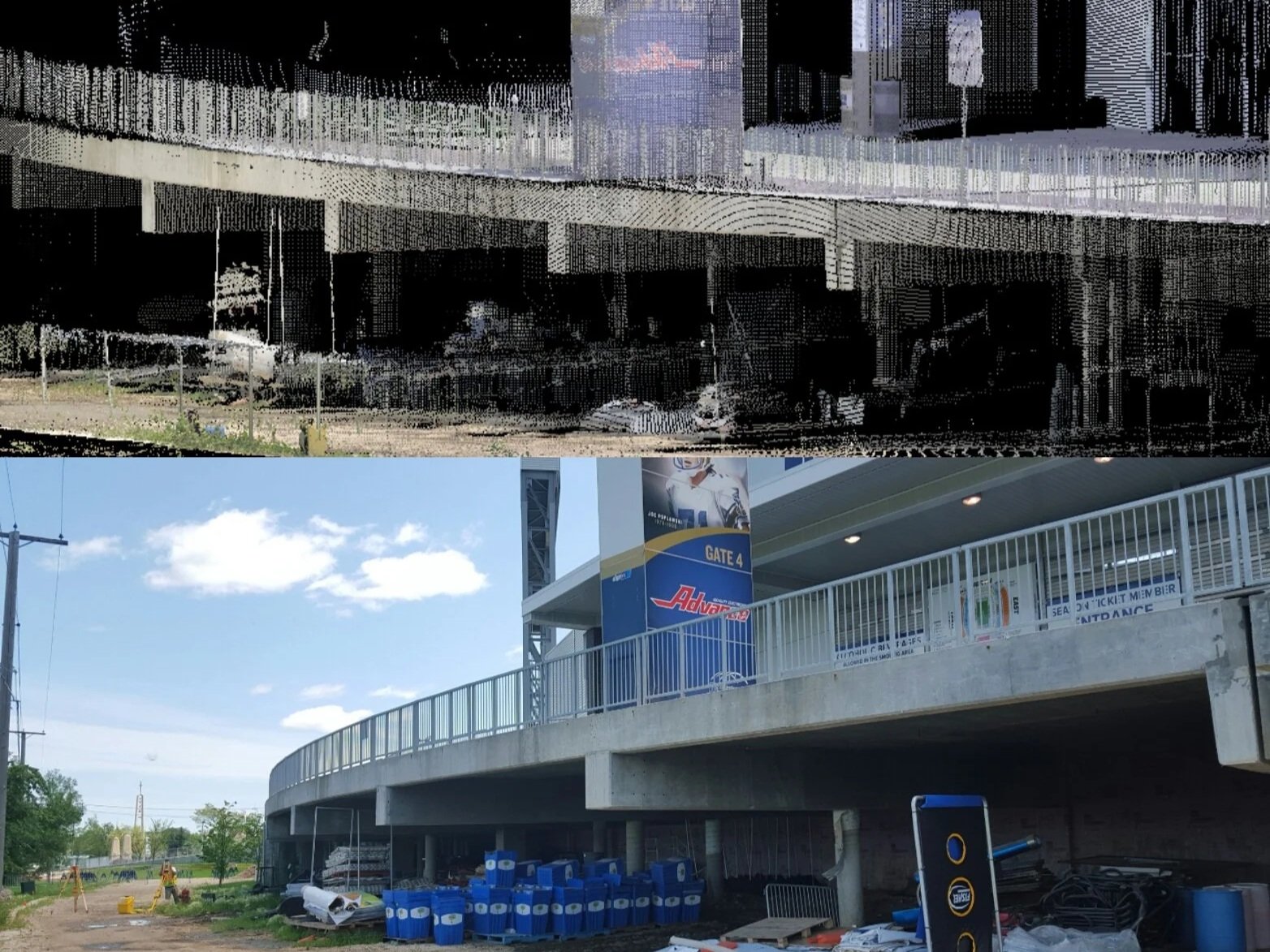
3D SCANNING
Our 3D Scanning and Reality Capture services provide highly accurate, data-rich digital representations of existing conditions to support engineering, construction, and facility management workflows. By capturing precise spatial data of buildings, infrastructure, and terrain, these services deliver a reliable foundation for design validation, clash detection, renovation planning, and asset documentation, reducing uncertainty and improving decision-making across project lifecycles.
Using advanced equipment such as the Trimble SX12, we collect millions of high-density measurement points to generate detailed 3D point clouds with exceptional accuracy and clarity. These datasets can be integrated into CAD, BIM, and GIS platforms to support modeling, analysis, and visualization, enabling teams to virtually inspect sites, verify dimensions, and identify potential issues before work begins.
The result is a comprehensive digital record of existing conditions that enhances efficiency, minimizes rework, and supports informed, data-driven project execution.
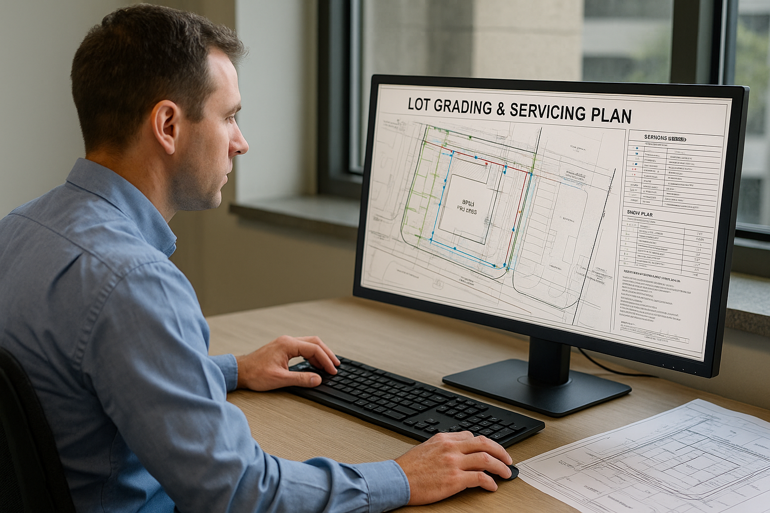
LOT GRADING & SERVICING DESIGN
Our Lot Grading and Servicing Design solutions provide property owners, developers, and builders with comprehensive, engineered plans that support safe drainage, compliant servicing, and efficient construction from start to finish.
Each design is developed using accurate site data and a clear understanding of local conditions to ensure proper grading, positive drainage, and effective stormwater management that protects structures and surrounding properties.
Whether developing a new site, constructing an infill home, or upgrading an existing property, our team prepares detailed grading and servicing plans that align with municipal standards and regulatory requirements. By coordinating design elements such as water, sanitary, and storm services with site grading, we help streamline approvals, reduce construction challenges, and deliver practical, build-ready solutions that support long-term site performance.
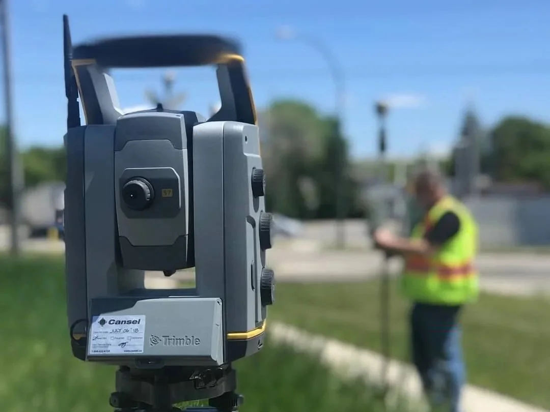
TOPOGRAPHIC SURVEY
Our Topographic Survey services aim is to document the natural and man-made features of a property along with their precise horizontal locations and elevations. It provides a detailed representation of existing site conditions by capturing ground elevations, contours, slopes, drainage patterns, and visible features such as buildings, roads, utilities, trees, and water bodies.
Topographic surveys are essential for land development, engineering design, and construction planning. The data supports grading and servicing design, stormwater management, infrastructure layout, and regulatory approvals by giving designers and engineers a clear understanding of site constraints. Accurate topographic information reduces uncertainty, supports efficient design, and helps ensure projects move forward with confidence.
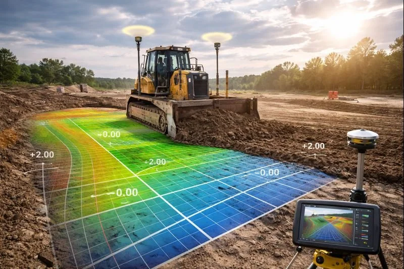
MACHINE CONTROL & TECHNICAL SERVICES
Our Machine Control and Technical Services provide contractors and project teams with the digital tools and precise data required to maximize efficiency and accuracy on today’s GPS-guided construction equipment. By converting survey and design information into machine-ready files, we enable dozers, excavators, and graders to work directly from accurate 3D models, reducing reliance on traditional staking and improving productivity in the field.
We prepare customized surface models, alignments, and control files compatible with leading machine control systems, ensuring seamless integration with GPS and robotic equipment. In addition, our volumetric calculations deliver reliable cut-and-fill quantities for earthworks planning, bidding, progress tracking, and cost control. From initial site preparation through final grading, our machine control and volumetric solutions help streamline operations, reduce rework, and deliver projects with greater accuracy and confidence.