
Land Development Survey
& Construction
Comprehensive Geomatics and Site Design Support for Residential and Industrial Land Development
Land Development Survey
Land development is the highly technical and strategic process of transforming raw, unrefined acreage into functional, high-value assets—ranging from sprawling residential communities and modern industrial parks to vibrant commercial centers. This complex transition is far more than a physical construction project; it is a multi-layered orchestration of legal, engineering, and environmental variables that must align perfectly. It requires a meticulous, high-precision approach to geomatics to ensure that every individual lot, arterial roadway, and underground utility corridor is positioned with mathematical certainty exactly where it belongs within the spatial fabric of the site.
In this high-stakes environment, professional surveying acts as the "living" master blueprint in the field, bridging the gap between a designer’s vision and the physical earth. Surveyors navigate the dense complexities of municipal zoning requirements, intricate drainage designs, and historical property boundaries to create a seamless, risk-mitigated path from the initial conceptual sketch to a fully buildable, code-compliant reality. Without this foundational layer of geospatial intelligence, the risk of structural failure, legal disputes, and drainage disasters increases exponentially. By establishing sub-centimeter accuracy before the first shovel hits the dirt, construction surveying ensures that the massive investments made in land development are protected by a framework of technical integrity and long-term structural viability.
Here is a detailed breakdown of how professional geomatics drives the success of land development projects:
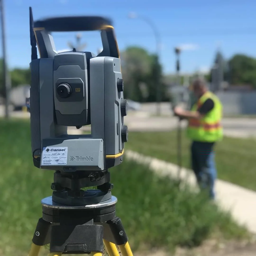
The Foundation: Boundary Control and Topographic Intelligence
Every development project begins with a clear understanding of the site's physical and legal constraints. Surveyors establish a Primary Control Network that serves as the anchor for the entire project lifecycle.
Boundary Verification: Before any design work begins, surveyors verify property lines and easements. This ensures the development remains strictly within legal limits, preventing costly encroachment disputes with neighboring landowners.
Topographic Mapping: Using a blend of traditional ground surveys and UAV (Drone) technology, geomatics teams create high-resolution maps that capture existing elevations, vegetation, and structures. This "base map" is the essential canvas upon which civil engineers design grading and drainage plans.
Site Design Support: Translating the Subdivision Plan
Once the design is finalized, the surveyor translates the abstract lines on a PDF into physical markers on the ground.
Subdivision Layout and Lot Staking: Surveyors mark the corners of every future lot, ensuring that each property meets the minimum size and setback requirements mandated by local bylaws.
Roadway and Right-of-Way Staking: The skeleton of any development is its road network. Surveyors provide precise layout for centerlines, curbs, and gutters, ensuring that the internal road system integrates perfectly with existing municipal infrastructure.
Grading and Drainage Control: Proper water management is the most critical factor in land development. Surveyors set "grade stakes" to guide earthmovers in shaping the land, ensuring that runoff flows away from future building footprints and into designated retention ponds or storm systems.
Utility Coordination: The Underground Network
A piece of land isn't "developed" until it is serviced. Surveyors provide the critical layout for the complex web of underground utilities that will support future occupants.
Sewer and Water Alignment: Ensuring that gravity-fed sanitary and storm lines are installed at the exact depth and gradient required to function without pumps.
Joint Use Trenching: Coordinating the layout for shallow utilities like electrical, gas, and fiber optics. By staking these corridors accurately, surveyors help prevent utility strikes and ensure that service pedestals are placed correctly within the designated easements.
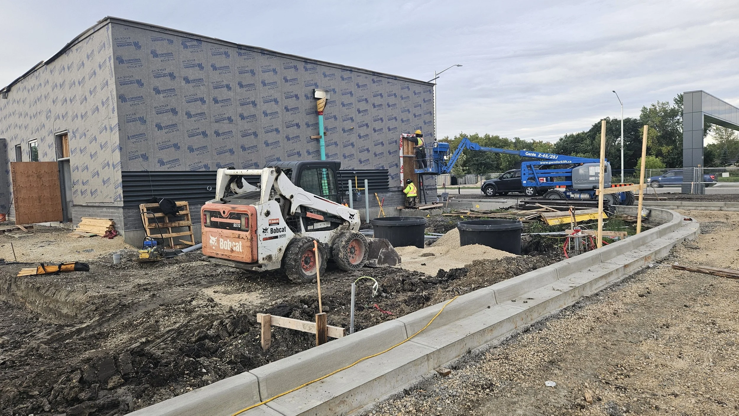
Construction Verification: Quality Control in the Field
As construction progresses, the surveyor acts as the project’s eyes and ears, providing real-time verification of the work being performed.
Building Pocket Verification: Before foundation excavation begins, surveyors stake out "building pockets" or envelopes. This confirms that the proposed house or building will fit within the lot's setbacks and that the finished floor elevation (FFE) will meet the overall drainage plan.
Interim Volume Audits: For large-scale grading operations, surveyors perform volumetric analysis to track how much material has been moved. This provides transparency for progress payments and ensures that the site is reaching its designed elevations efficiently.
Compliance and Handover: The Final Record
The final phase of land development involves proving to municipal authorities that the project was built as designed.
As-Built Surveys: Once infrastructure is in the ground, surveyors capture the exact location of every manhole, valve, and property pin. This data is compiled into "As-Built" or "Record Drawings."
Certificate of Compliance: In many jurisdictions, a surveyor’s verification is required to release development bonds or to allow for the issuance of building permits. This final stamp of approval provides the developer, the city, and future homeowners with the confidence that the infrastructure is safe, legal, and built to last.
By providing sub-centimeter accuracy from the initial boundary survey to the final as-built record, professional geomatics ensures that land development projects are executed with technical precision and long-term viability.